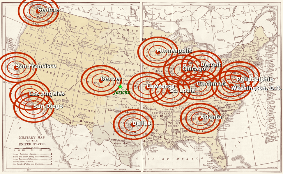
I have updated my map of the bombing sites to include the new information reported by Gray Anderson in the November 1 episode. New York City[1] and Kansas City[2] have been removed. Washington, D.C. has been added. I also made a more accurate rendering of the nation's three power grids to neaten up my crude overlay from the last post. I included it at 20% opacity for this week's map. The actual power grid data points have been omitted for purposes of clarity:
November 2nd Bombing Map
Citations:
[1] According to Gray Anderson, NYPD confiscated and disabled a nuclear bomb found in a rental truck moments before detonation. New York thus survived the initial round of attacks.
[2] Kansas City was included on the October 22nd map because it was mentioned on the retrieved flight data recorder and appeared to be one of the pins on Robert Hawkins's map. We now have more firm testimony that Lawerence was nuked. The close geographic proximity between Lawrence and Kansas City (from a vantage point in the northwest corner of Kansas and on a map) allows us to assume it was Lawrence that was pinned and the Lawrence mushroom cloud that the pilot mistaked for Kansas City.
Thursday, November 02, 2006
Subscribe to:
Posts (Atom)
